New York State, renowned for its diverse landscapes, is also home to a thriving, yet often challenging, white-tailed deer population. Understanding where these deer live, how their numbers fluctuate, and the impacts they have can be complex, especially when trying to grasp the situation at a county level. This complete guide offers an in-depth look at the New York deer population by county, detailing current trends, management efforts, and the critical factors that shape these vital wildlife populations. With expert analysis and trusted information, this professional resource aims to provide a reliable understanding of deer dynamics across the Empire State.
Understanding New York Deer Population by County: Why Local Numbers Vary
📤 Share Image
New York State is home to a substantial and dynamic white-tailed deer population, a species that has profoundly shaped the state’s natural and human-modified landscapes. While often perceived as a ubiquitous presence, the reality is that deer numbers are not uniform; they vary significantly across different counties and regions. This variability is not random but rather a consequence of intricate ecological, historical, and anthropogenic factors. As seasoned professionals in wildlife management understand, a county-level analysis provides critical insights often lost in broader state-wide averages, forming the bedrock of effective, localized management strategies.

The Importance of White-tailed Deer in NY Ecosystems
White-tailed deer (Odocoileus virginianus) are more than just a popular game animal; they are a keystone species within New York’s ecosystems. Their browsing habits influence forest regeneration, plant diversity, and the structure of understory vegetation. A healthy deer population is indicative of a functional ecosystem, yet overpopulation can lead to significant ecological imbalances, including excessive browse pressure that alters plant communities and negatively impacts other wildlife species. The New York State Department of Environmental Conservation (NYSDEC) recognizes this delicate balance, making their careful monitoring of the new york deer population by county an indispensable task.

Key Factors Influencing Local Deer Density
The dramatic differences in deer density from one county to the next are directly attributable to several interacting factors. Foremost among these is habitat quality and availability. Counties with extensive contiguous forests, agricultural lands, and diverse vegetation often support higher deer numbers due to ample food and cover. Conversely, areas with limited suitable habitat or fragmented landscapes may exhibit lower densities. Human development, particularly suburban sprawl, also plays a paradoxical role: while it reduces overall habitat, it can create “edge” environments rich in food sources and often provides sanctuaries from hunting pressure, leading to localized population spikes. Furthermore, the presence or absence of natural predators, severe winter weather, and disease outbreaks contribute to the ebb and flow of local deer numbers.
Historical Shifts in New York’s Deer Landscape
New York’s deer landscape has undergone profound historical shifts. From near extirpation in the late 19th century due to unregulated hunting and deforestation, populations have rebounded dramatically thanks to conservation efforts, habitat recovery, and active management. This recovery, however, has not been uniform. Areas like the Adirondack counties, historically characterized by harsh winters and dense conifer forests, tend to support lower deer densities compared to the fertile agricultural regions of Western New York or the mixed forests and suburban fringes of the Hudson Valley. For instance, comparing the relatively low densities in a heavily forested, high-elevation county like Hamilton to the often higher densities in a suburbanizing county like Westchester immediately illustrates the influence of habitat and human interface on the new york deer population by county. This historical context is vital for understanding current population dynamics and for projecting future trends.
Reliable Methods for Estimating New York County Deer Populations
Accurately estimating the new york deer population by county is a cornerstone of effective wildlife management. It’s a complex scientific endeavor that goes far beyond anecdotal sightings. As experts, we rely on a suite of survey and monitoring methodologies to develop robust, professional, and trusted population figures. The NYSDEC employs a multi-faceted approach, recognizing that no single method provides a complete picture, and that population figures are inherently approximations given the challenges of counting elusive wildlife over vast, diverse landscapes.
Leveraging Harvest Data and Hunter Reporting
One of the most crucial and widely utilized sources of information for estimating deer population density is harvest data. Each year, hunters are required to report their deer harvests to the NYSDEC. This comprehensive dataset provides invaluable insights into the age structure, sex ratios, and overall health of the deer herd. Biologists analyze this data meticulously, using sophisticated population models that factor in harvest rates, hunter effort, and trends in deer characteristics (e.g., antler development, fawn production). For example, a sustained increase in the harvest of older bucks or a consistent high percentage of yearlings in the antlered harvest can signal a growing or stable population, while declining fawn-to-doe ratios might suggest stress or declining productivity. This reliance on hunter-provided information underscores the collaborative nature of wildlife management in New York.
Advanced Survey Techniques: Aerial and Spotlight Counts
Beyond harvest data, the NYSDEC employs various direct observation techniques to refine its population estimates. Aerial surveys, often conducted in winter when snow cover makes deer more visible against the landscape, provide broad-scale density estimates in specific regions, particularly in less accessible areas. While weather-dependent and costly, these surveys offer a snapshot of distribution and concentration. Spotlight counts, typically performed at night along fixed routes, involve illuminating fields and forest edges to count deer. These provide indices of abundance and can track changes in local populations over time. While direct counts are valuable, they are often used as an index (a measure of relative abundance) rather than an absolute count, which is then integrated into more complex population models that combine multiple data sources for a higher quality estimate.
Understanding Wildlife Management Units (WMUs)
The NYSDEC manages deer populations not just at the county level but often within more granular Wildlife Management Units (WMUs). These WMUs are geographically defined areas that share similar habitat characteristics, land use patterns, and deer population dynamics, sometimes encompassing parts of multiple counties or several WMUs within a single county. This approach allows for more targeted management decisions, as deer behavior and ecological conditions often align more closely with WMU boundaries than with arbitrary political lines. Population estimates and management objectives, such as antlerless deer permit allocations, are frequently set at the WMU level, providing a pragmatic framework for localized control. This expert approach ensures that management efforts are finely tuned to the specific ecological realities on the ground.
New York Deer Population by County: Density, Trends, and Hotspots Analyzed
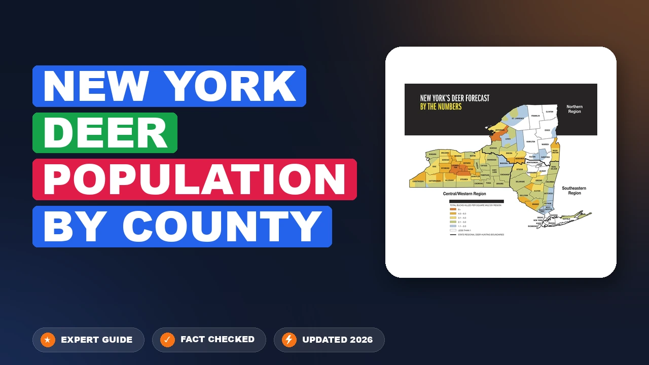
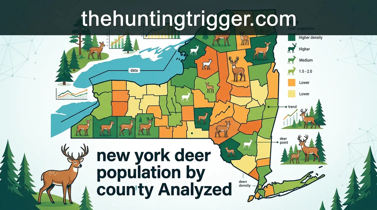
An in-depth analysis of the new york deer population by county reveals a mosaic of densities and trends, reflecting the diverse ecological and anthropogenic pressures across the state. Deer populations in New York vary significantly from county to county and across different regions, providing a critical guide for targeted management strategies. This professional information is derived from continuous monitoring and robust data collection by the NYSDEC.
County-Specific Deer Density and Management Zones
Deer population density varies widely across counties, often expressed as deer per square mile of habitat. Some counties exhibit remarkably high densities, particularly in regions with a mix of agricultural land and suburban development, which provide abundant food sources and often reduced hunting pressure. For instance, parts of the Hudson Valley and Western New York typically report higher densities due to excellent habitat and fragmented landscapes. In contrast, large portions of the Adirondack and Catskill Parks, characterized by less fertile soils, extensive wilderness, and harsher winters, generally maintain lower deer per square mile. These variations are meticulously tracked through deer population estimates and inform the designation of specific geographic units (Counties/Wildlife Management Units) for management purposes.
Tracking Population Trends: Growth, Stability, or Decline
Beyond static density figures, understanding the population trend—whether numbers are growing, stable, or declining—is paramount. The NYSDEC consistently monitors these trends on a county-by-county and WMU basis. Some counties might exhibit increasing or stable trends due to factors such as favorable weather, abundant food, or conservative harvest regulations. Other areas might show decreasing numbers, perhaps due to increased hunting pressure, habitat loss, or increased coyote populations. This dynamic information allows the NYSDEC to adapt its management approach, adjusting hunting seasons or permit allocations to meet specific objectives for that particular area. Trusted data collection over years provides the reliable insights needed for these critical adjustments.
Regional Breakdown: Eastern, Central, and Western NY Variations
A broad regional perspective further illuminates the variations in the new york deer population by county:
- Eastern New York (Hudson Valley, Capital Region): Many counties here exhibit high deer densities, particularly in suburban-rural interfaces. Abundant forage from agriculture and ornamental plantings, coupled with reduced hunting access in developed areas, often leads to robust populations and associated challenges.
- Central New York (Finger Lakes, Southern Tier): This region typically maintains moderate to high densities. Excellent agricultural habitat provides ample food, sustaining healthy populations across many counties. Management here often focuses on balancing agricultural interests with recreational hunting opportunities.
- Western New York: Similar to Central NY, many counties here support thriving deer populations due to rich agricultural lands and diverse habitats. Some of the highest deer harvest numbers often originate from this region, reflecting healthy population levels and active hunter engagement.
- Northern New York (Adirondacks): The vast wilderness of the Adirondack Park generally supports lower deer densities. Harsh winters, extensive unbroken forests, and limited agricultural activity naturally limit population growth. Management here often prioritizes herd health and sustainability in a more challenging environment.
- Long Island/NYC Metro Area: Pockets of extremely high density exist in suburban areas like Suffolk County (Long Island) and Staten Island, often due to lack of hunting and abundant ornamental vegetation. These areas present unique management challenges, demanding innovative and hyper-localized solutions.
By The Numbers: New York Deer Management Focus
Geographic Management Units
Deer Harvested Annually
County Population Densities
Population Trend Monitoring
How NYSDEC Manages the New York Deer Population by County Effectively
The management of the new york deer population by county is a sophisticated and dynamic process overseen by the NYSDEC. Their approach is guided by clear management objectives and policies designed to balance deer health, ecological impacts, human safety, and recreational opportunities. This is not a one-size-fits-all solution; rather, it’s an adaptive strategy that recognizes the unique circumstances of each county and Wildlife Management Unit. The NYSDEC’s commitment to quality data and expert analysis ensures that management decisions are both professional and effective.
Hunting Regulations: A Primary Management Tool
Undeniably, hunting is a critical and widely used tool for managing deer populations across New York. It remains the most effective and economically viable method for controlling deer numbers, particularly does, which are key to population growth. The NYSDEC meticulously crafts hunting regulations each year, adjusting season lengths, bag limits, and antlerless deer permit allocations based on population objectives for specific WMUs. For example, in counties or WMUs with high deer densities and ecological concerns, the NYSDEC may issue a greater number of Deer Management Permits (DMPs), allowing hunters to harvest additional antlerless deer. Conversely, in areas where populations are below objective, DMPs may be reduced or eliminated to allow for population growth. This level of granular control is a testament to the trusted scientific foundation of NYSDEC’s approach.
Deer Management Assistance Program (DMAP) for Local Control
For situations requiring even more localized and intensive management, the NYSDEC offers the Deer Management Assistance Program (DMAP). DMAP allows landowners, farmers, and municipalities to request special antlerless deer permits to address specific deer-related issues on their property or within their jurisdiction. These issues often include significant agricultural damage, severe forest regeneration problems, or public safety concerns in areas with limited hunting access. For instance, a farmer in an agricultural county experiencing chronic crop damage can apply for DMAP permits to allow hunters to take more deer on their land. This program provides a crucial, flexible tool that allows for highly targeted management efforts, complementing broader regional regulations and addressing unique local challenges effectively.
Balancing Ecological Carrying Capacity with Management Goals
A core principle of NYSDEC deer management is striving to balance deer populations with the ecological carrying capacity of the land, while also considering human tolerance levels. Ecological carrying capacity refers to the maximum number of deer an ecosystem can support without long-term damage to the habitat or the deer herd itself. However, in many areas, the social or cultural carrying capacity (the number of deer humans are willing to tolerate) is often lower than the ecological carrying capacity due to impacts like vehicle collisions or landscape damage. The NYSDEC’s management goals, therefore, are set to achieve target population levels that minimize negative impacts while sustaining a healthy deer herd for recreational and ecological benefits. This careful, professional balancing act relies on continuous monitoring and adaptive adjustments to new york deer population by county data.
Addressing the Impacts of New York Deer Populations: Challenges & Solutions
While a healthy new york deer population by county is a testament to successful conservation, high deer densities can lead to significant challenges that impact ecosystems, human safety, and economic well-being. Deer populations have substantial impacts on local ecosystems, agriculture, forestry, and public safety (e.g., vehicle collisions, disease transmission). Addressing these issues requires a comprehensive, expert approach that combines active management with public awareness and engagement. This section provides quality information on these challenges and the ongoing efforts to mitigate them.
Minimizing Vehicle-Deer Collisions and Public Safety Risks
One of the most immediate and tangible public safety concerns related to deer is vehicle-deer collisions. New York State experiences tens of thousands of these accidents annually, resulting in millions of dollars in property damage, and tragically, numerous human injuries and even fatalities. Counties with high deer populations and extensive road networks, particularly those at the rural-suburban interface, tend to report the highest incidence of these collisions. The NYSDEC works with DOT and local agencies to identify hotspots, and effective deer management through hunting remains the most reliable long-term strategy to reduce overall deer numbers and thus collision rates. Drivers are routinely advised to be vigilant, especially during dawn and dusk, when deer are most active. This trusted information helps save lives and reduce property loss.
Protecting Agriculture and Forests from Deer Damage
High deer densities can inflict considerable economic impacts on farmers and landowners through agricultural and forest damage. Deer browsing can destroy crops like corn, soybeans, and orchards, significantly reducing yields and profitability for farmers. In forest ecosystems, intensive browsing by deer can prevent the regeneration of valuable timber species and reduce overall biodiversity by eliminating palatable understory plants. This “browse line” effect is a clear indicator of an overpopulated deer herd. The DMAP program, along with fencing and repellents, offers localized solutions for landowners, but widespread control of the new york deer population by county through regulated hunting is essential for preventing broad-scale ecological and economic damage. Our professional insights confirm the persistent nature of this challenge.
Deer and Tick-Borne Diseases: A Public Health Concern
Deer play a critical role in the life cycle of blacklegged ticks (Ixodes scapularis), which are vectors for various tick-borne diseases, most notably Lyme disease. While deer do not carry Lyme disease themselves, they are the primary host for adult blacklegged ticks, enabling the ticks to reproduce and disperse. Consequently, areas with high deer densities often correlate with higher tick populations and an increased risk of human exposure to tick-borne illnesses. This constitutes a significant public health concern across many New York counties. While reducing deer numbers can decrease tick populations over time, other interventions like personal protection and habitat management are also crucial. Predators like coyotes and bears do play a natural role in deer population regulation, but their impact alone is rarely sufficient to control densities to levels that significantly mitigate these human-wildlife conflicts, particularly in fragmented or suburban landscapes. Therefore, human intervention, grounded in reliable data and expert guidance, remains indispensable.
New York’s white-tailed deer population is an integral, yet complex, part of the state’s natural heritage. This analysis reveals that the new york deer population by county varies significantly, driven by a confluence of habitat quality, human development, and historical factors. The NYSDEC employs a range of scientific methods, from harvest data analysis to aerial surveys, to produce quality and reliable population estimates. Active management, primarily through regulated hunting and the targeted DMAP program, is essential for balancing ecological health with critical human safety and economic impacts. However, ongoing challenges such as vehicle collisions, agricultural damage, and the prevalence of tick-borne diseases necessitate continued professional monitoring and adaptive strategies. To foster safe coexistence with this magnificent species, it is crucial for all New Yorkers to stay informed about local deer management plans and contribute by driving cautiously, especially during peak deer activity hours, and supporting responsible wildlife management initiatives.
New York Deer Population by County: Frequently Asked Questions
How is the deer population estimated for each county in New York?
The New York State Department of Environmental Conservation (NYSDEC) employs multiple robust methods. Primary among these are analyzing deer harvest data from hunters, which provides insights into population age and sex ratios. Supplemental techniques include aerial surveys, particularly in specific management units, and road-kill statistics. These data points are integrated into sophisticated population models to generate scientifically reliable county-level estimates, accounting for inherent biological and statistical variability.
Why do some New York counties have significantly more or fewer deer than others?
Deer population disparities across New York counties stem from a confluence of ecological and anthropogenic factors. Key influences include habitat availability (e.g., forests, agricultural lands), food sources, land use patterns, and human development levels. Predation pressure and historical management strategies also play roles. Counties with abundant suitable habitat and less urbanized areas, often in Western or Central NY, typically support higher densities, while highly urbanized or extensively forested regions may have fewer.
What actions is the NYSDEC taking to manage deer populations at the county level?
The NYSDEC implements a multi-faceted approach to county-level deer management. This includes regulating hunting seasons and bag limits, often adjusting these based on local population objectives. They also engage in habitat management initiatives, public education campaigns, and provide technical assistance for landowners facing deer-related conflicts. Specific management units may also utilize controlled hunts or other targeted interventions in areas of overpopulation, always aiming for ecological balance and public safety.
Are deer considered overpopulated in any particular New York counties?
Yes, deer are considered overpopulated in several New York counties, particularly in suburban and agricultural areas where abundant food sources and limited predation lead to high densities. Examples often include counties in the Hudson Valley and Long Island, where deer impacts on ecosystems, agriculture, and public safety (e.g., vehicle collisions) become significant. The NYSDEC continuously monitors these situations and adjusts management strategies to mitigate adverse effects of overabundance.
Where can I find current or historical deer population data for a specific New York county?
Current and historical deer population data for specific New York counties are primarily available through the official New York State Department of Environmental Conservation (NYSDEC) website. Their ‘Deer and Bear Harvest Reports’ and annual wildlife surveys provide detailed county-level harvest statistics, population estimates, and management unit information. These reports are updated regularly, offering invaluable resources for researchers, wildlife enthusiasts, and stakeholders seeking reliable data on local deer populations.

Leave a Reply